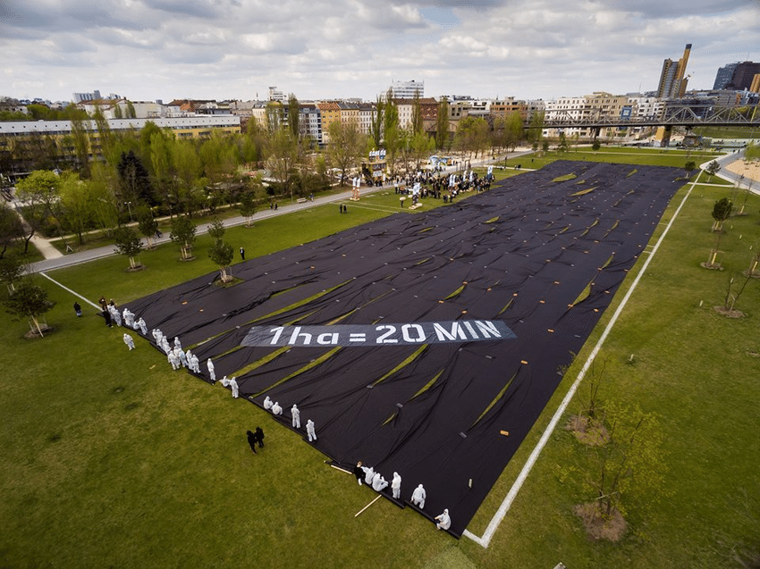
Soil sealing – also called imperviousness – is defined as a change in the nature of the soil leading to its impermeability. Soil sealing has several impacts on the environment, especially in urban areas and local climate, influencing heat exchange and soil permeability; soil sealing monitoring is crucial for the Mediterranean coastal areas, where soil degradation combined with drought and fires contributes to desertification.
The project Mediterranean Soil Sealing, promoted by the European Space Agency (ESA) in the frame of the EO Science for Society – Mediterranean Regional Initiative, aims to provide specific products related to soil sealing and its degree over the Mediterranean coastal areas by exploiting EO data with an innovative methodology capable to optimize and scale-up their use with other non-EO data. Such products have been designed to allow – concerning current practices and existing services – a better characterization, quantification and monitoring within time of soil sealing over the Mediterranean basin, supporting users and stakeholders involved in monitoring and preventing land degradation.
The project started in March 2021 and the final products are available in 2024. The project team is led by Planetek Italia, and composed of ISPRA and CLS.
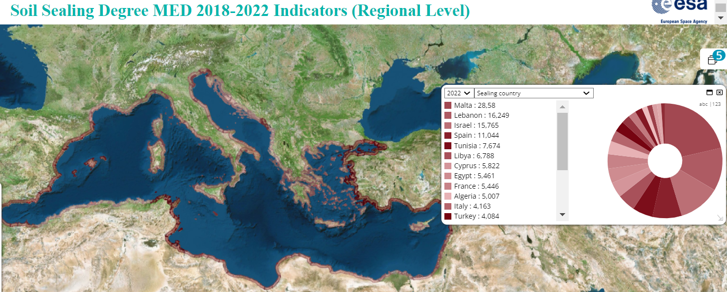
sealing-2022-per-country
Planetek Italia oversees the development of the infrastructure, the engineering of the algorithms and the communication activities. CLS oversees the soil sealing mask and experimental reversible soil sealing processing algorithms, ISPRA of the soil sealing degree processing algorithms. The interaction with the users is led by ISPRA, institutionally involved in the land degradation theme into international and regional organizations and the national body responsible for the theme in Italy.
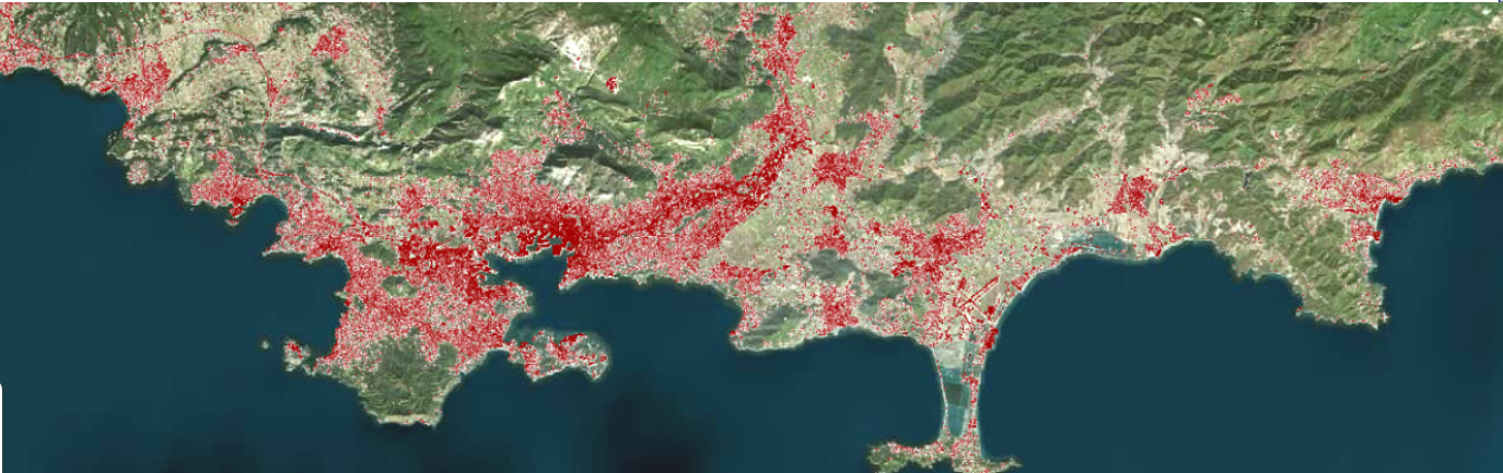
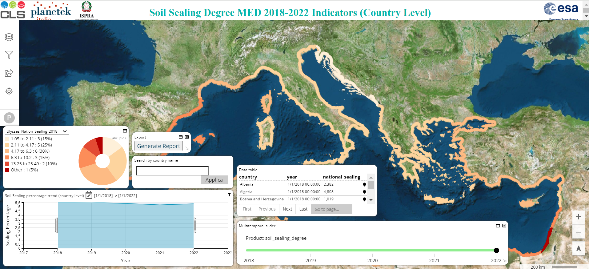
The targeted products are high-resolution maps of the degree of soil sealing over the Mediterranean coastal areas (within 20km from the coast) for the 2018-2022, at yearly temporal resolution with a targeted spatial resolution of 10m.
The involvement of stakeholders and end-users is an essential element of the project, as stated by ESA in the call for proposals. Since from the early stage of the proposal, efforts have been made to reach a diversity of users and stakeholders; the presence of ISPRA in the consortium is a plus for the project in this sense.
Users are grouped into classes: municipalities; sub-national agencies or local governmental institutions; national institutions and research centers; regional institutions and international. Users are kept updated and focused on project activities by providing them concrete elements on which to ask for direct feedback. The users are also involved in the definition of a new way to serve them the project results. Instead of delivering just a set of maps, the team develops an extensive collection of indicators and analytics integrated into an interactive dashboard that allows the users to access quickly and easily the information they need.
Project Information and access to the dashboard are available on the project website.
https://www.ulysses-project.org/