The Network organised together with the University of The Azores the virtual workshop on “EO4GEO- Skills development in Earth Observation and Copernicus User Uptake: the present and future of Coastal and Maritime sector- The Azorean case”. The objective of the workshop was to identify the current and future needs of EO/GI skills in coastal/maritime economic activities for the Azores and explore how the EO4GEOs solution can fit into the needs of LRAs, academia, companies, and other maritime stakeholders. Professor Gabriela Queiroz, The Vice-rector of the University of The Azores and Ms Roya Ayazi, NEREUS Secretary-General addressed the workshop. Mr Francisco Wallenstein introduced the region’s space activities. The workshop was moderated by Ms Margarita Chrysaki, NEREUS Communication/Project officer and Mr Artur Gil, Geospatial Research Engineer at IVAR – Research Institute for Volcanology and Risks Assessment – University of the Azores
More than 60 participants (out of 165 registered participants) had the chance to follow the discussion and interact with high-level speakers and the EO4GEO Alliance. In the first part of the workshop, 4 representatives from Academia, LRAs, Industry, and other maritime initiatives gave an overview on the current and future working skills needed for the Coastal/Marine Earth Observation’s activities in the Azores. In addition, Mr Antoni Jez (Podkarpackie region, PL) and Adam Sieczka (Mazovia region, PL) shared with the participants their expectations in organising the next EO4GEO workshops on 21st and 22nd October in Poland (you can download all presentations below).
In the second part of the workshop, the EO4GEO Alliance presented the EO4GEO tools, training actions, and training material that could support Public Authorities, academia, companies, and small and medium enterprises, and EO/GI experts. Further, the partners organised a hands-on session to explain how we can use and benefit from these solutions highlighting the knowledge and the skills needed to perform tasks in the Earth Observation maritime sector (you can download their presentation below).
You can download the agenda here (link).
You can download the presentations:
1st part of the workshop:
- Roya Ayazi_NEREUS presentation (link);
- Francisco Wallenstein_ The Azores presentation (link);
- Margarita Chrysaki_Introduction to EO4GEO (link);
- Pedro Das Neves_Current state of MSP activities in the Azores (link);
- Adam Sieczka_EO4GEO_Mazovia (link);
- Antoni_Jez_Podkarpackie (link);
- Ana Martins_University of the Azores (link);
- Pedro Silva_Employers challenges to find the right profile in the coastal_maritime sector (link);
- Fabio Vieira_Marine EO (link);
2nd part of the workshop:
You can watch the full workshop here:
Photo Gallery:
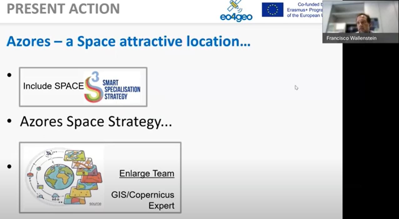
Francisco Wallenstein, The Azores region
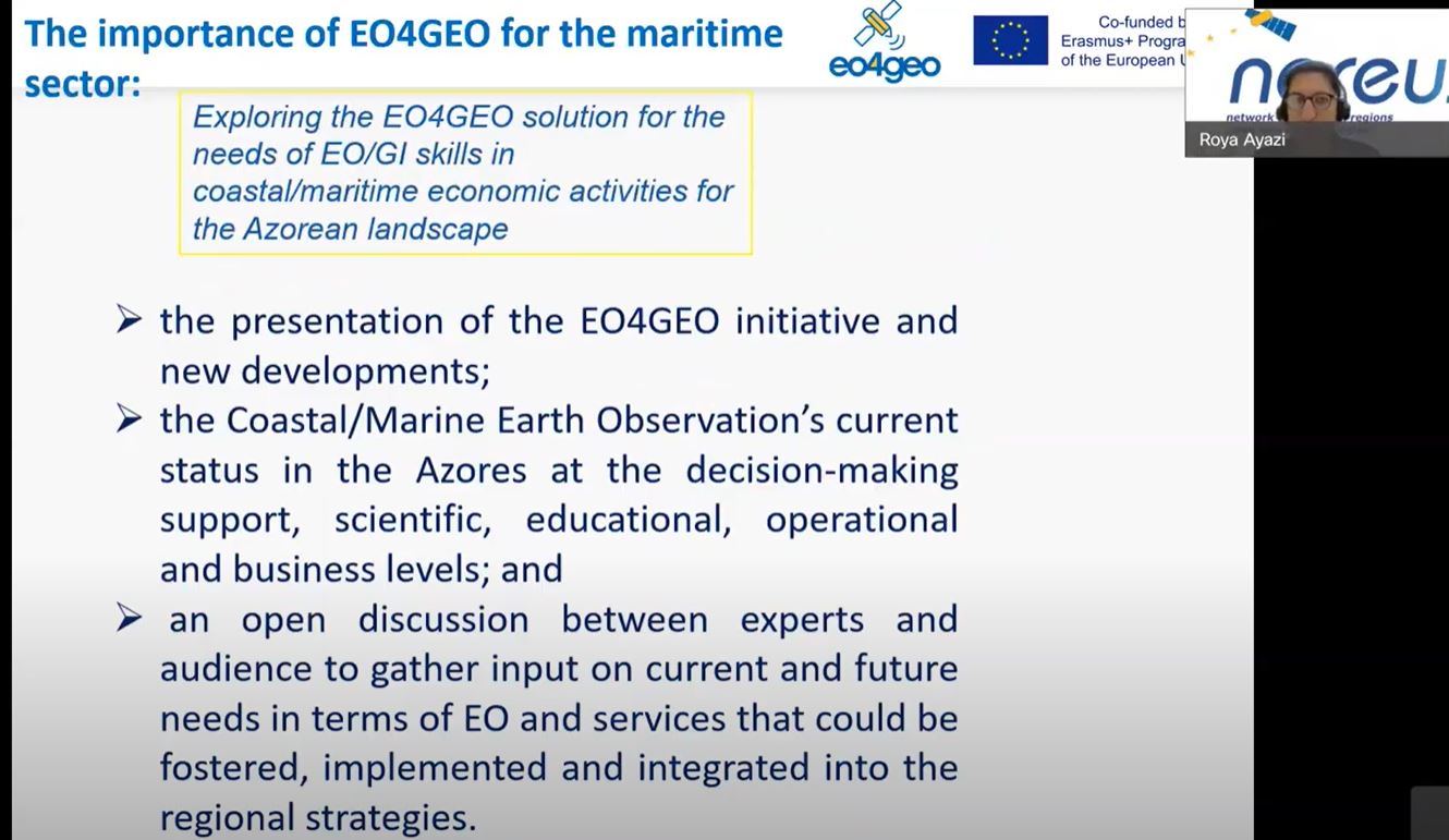
Roya Ayazi, NEREUS Secretary General
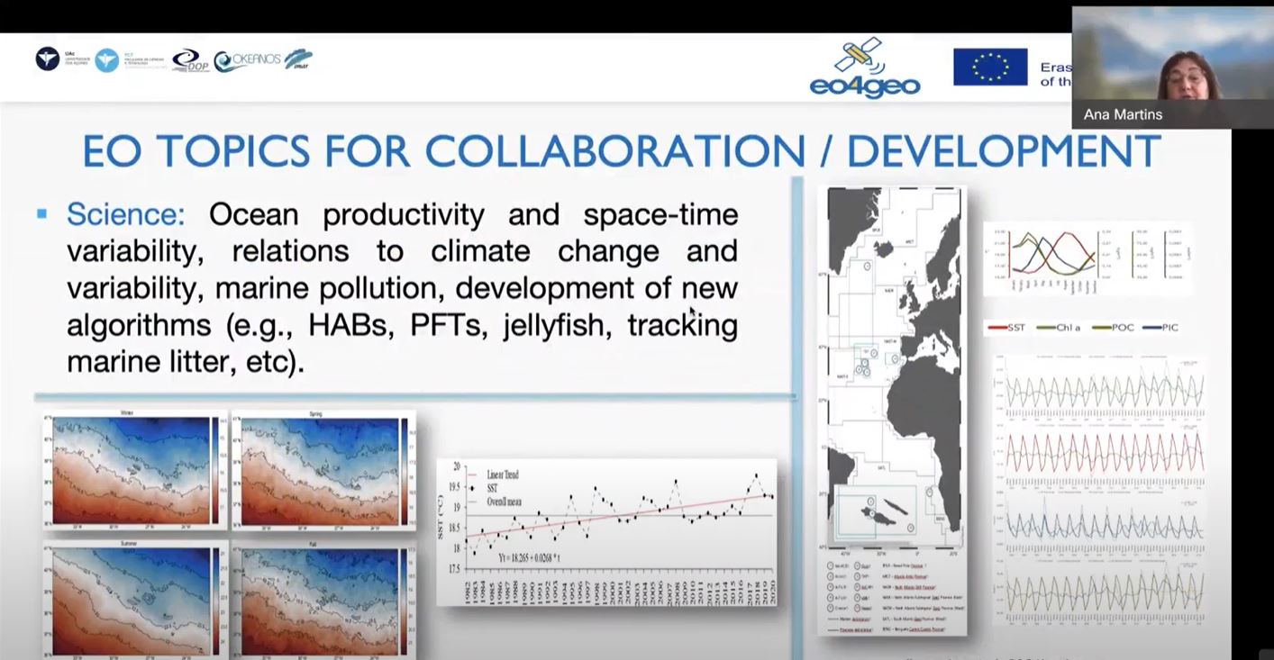
Ana Martins- Academia for the EO/GI skills development
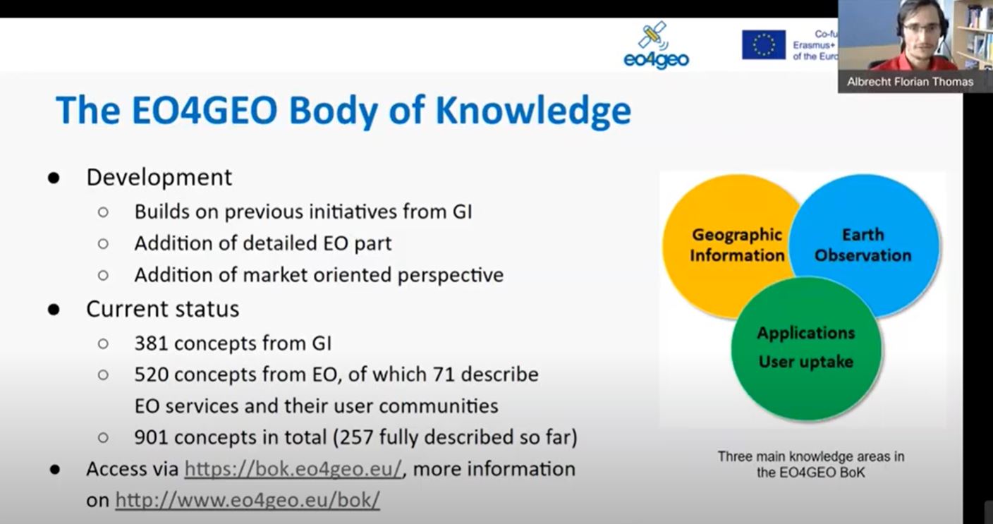
Florian Albrecht- presentation of the BoK
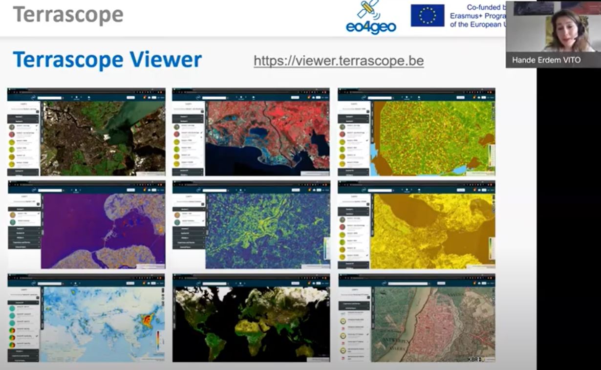
Hande Erdem- EO tools presentation
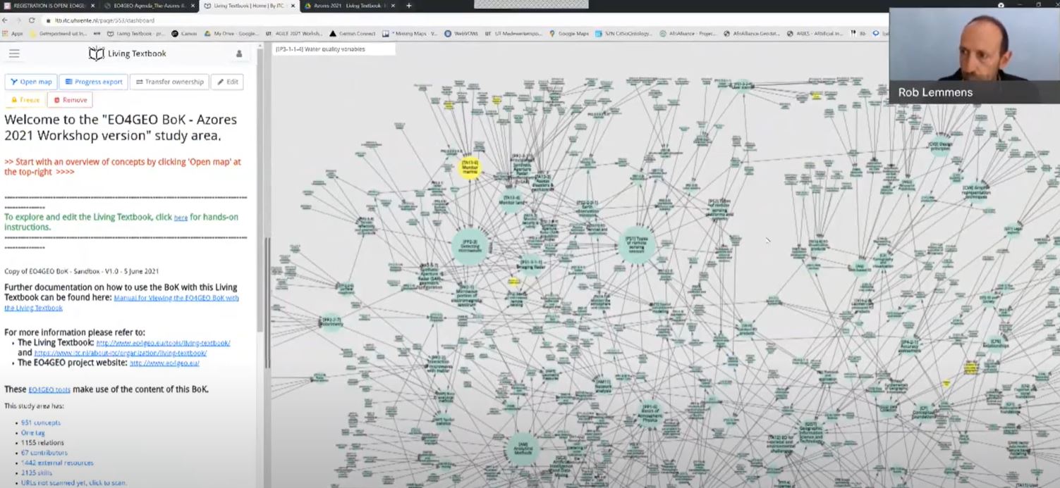
Rob Lemmens- EO4GEO presentation
About: The ERASMUS+ funded initiative EO4GEO (Towards an innovative strategy for skills development and capacity building in the space geo-information sector supporting Copernicus user uptake) under the Blueprint for Sectoral Cooperation on Skills schema aims to help bridging the skills gap in space/geospatial sector by creating a strong alliance of players from the sector/community reinforcing the existing ecosystem and fostering the uptake and integration of space/geospatial data and services.